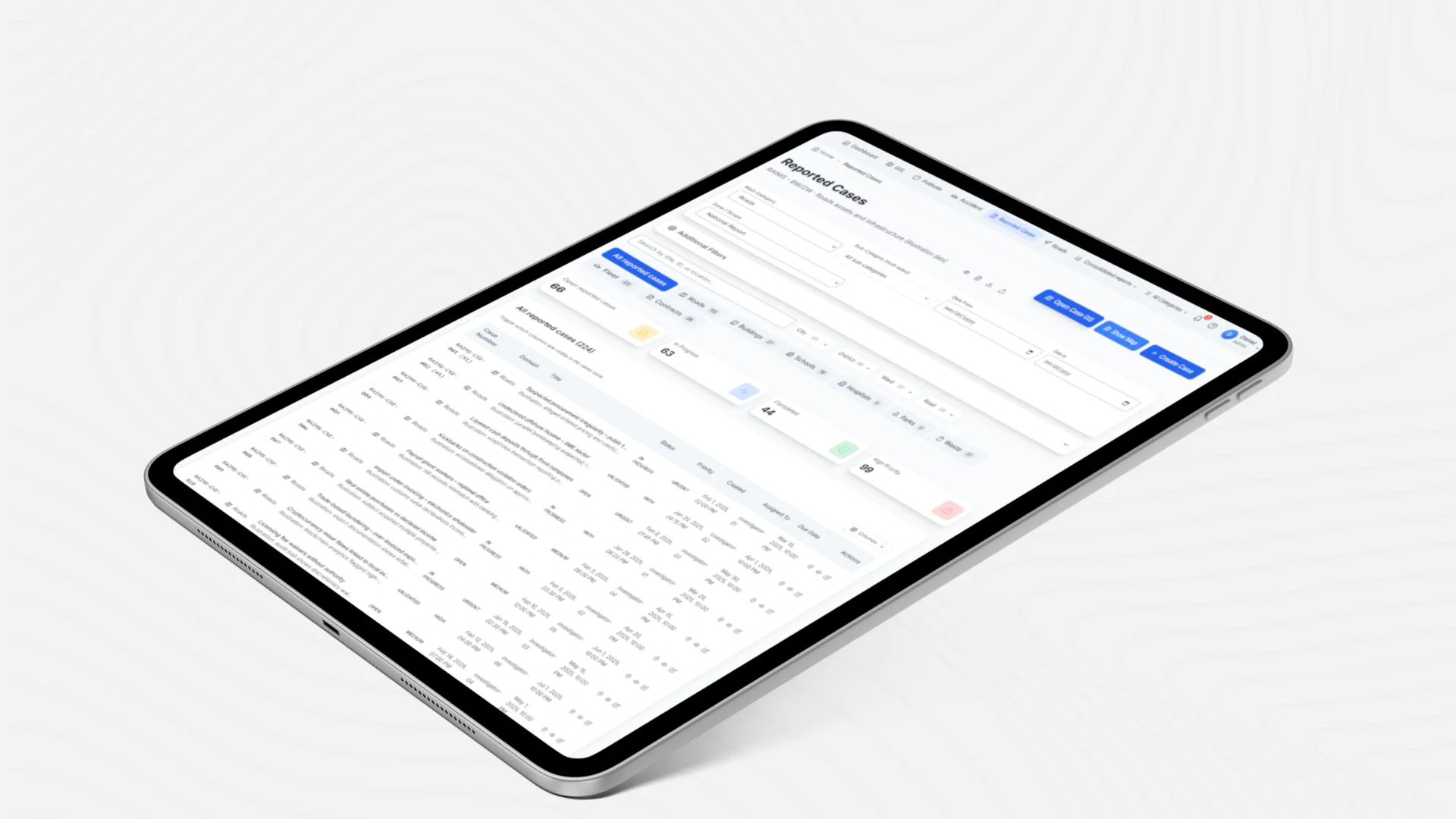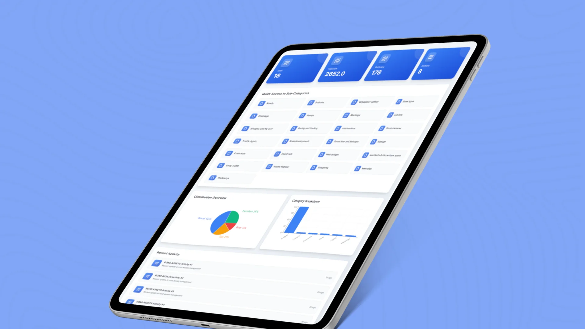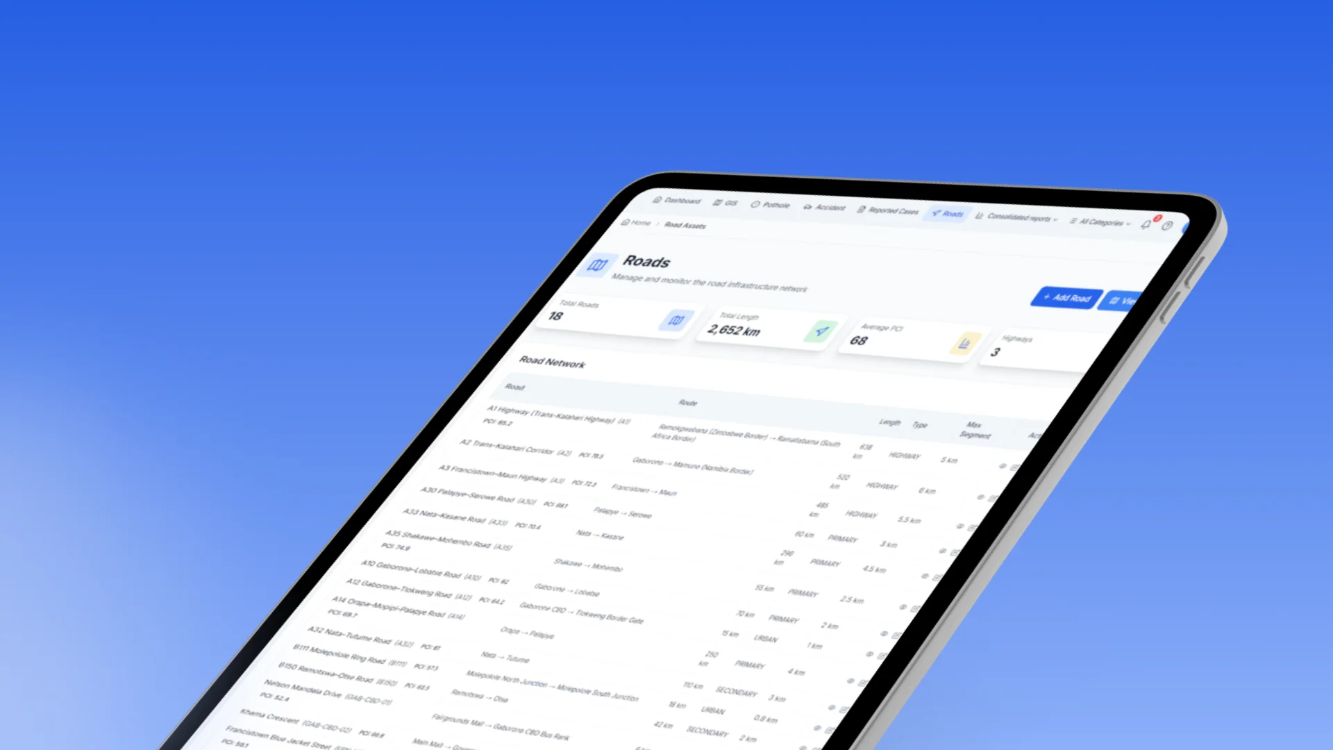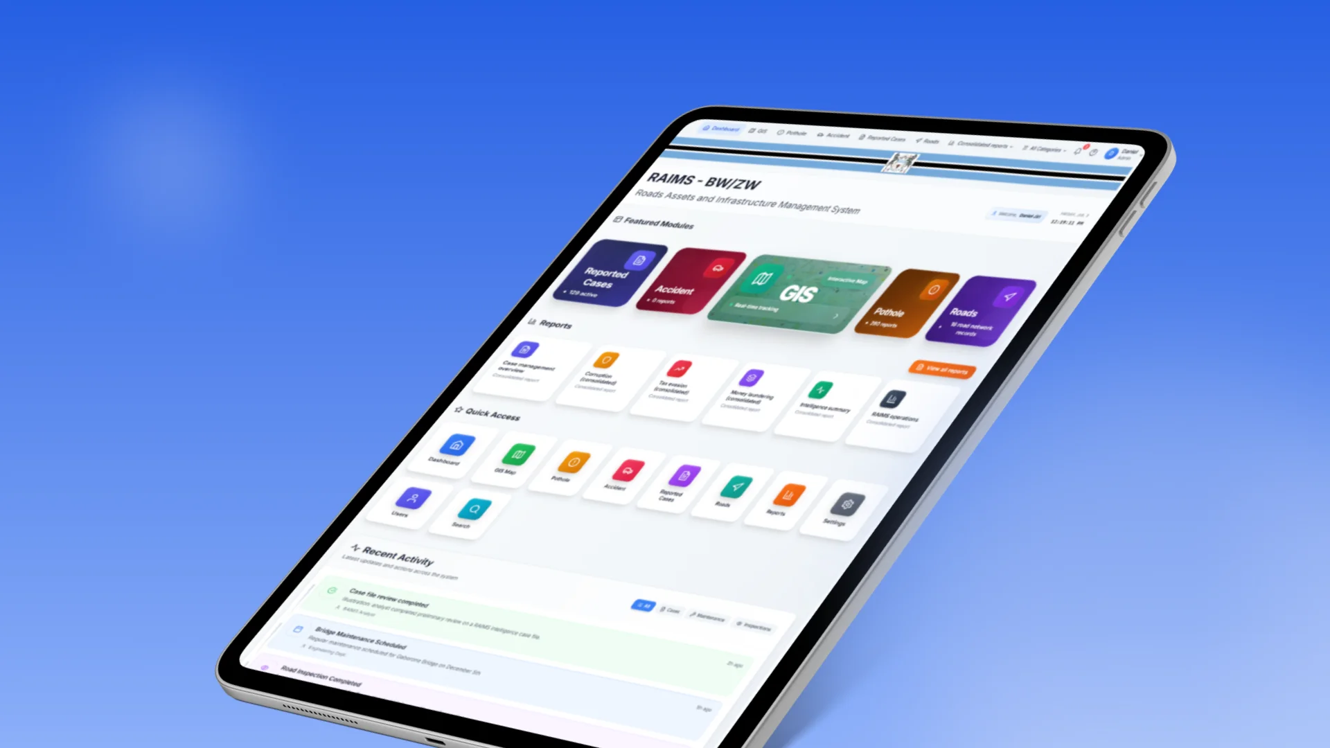

Multiple Infrastructure Domains
The platform needed to manage different types of public infrastructure through one consistent digital framework.

Road Safety Alliance
A cloud-based enterprise platform developed to manage road assets and public infrastructure through GIS mapping, role-based access, operational workflows, analytics, and reporting.
Project Overview
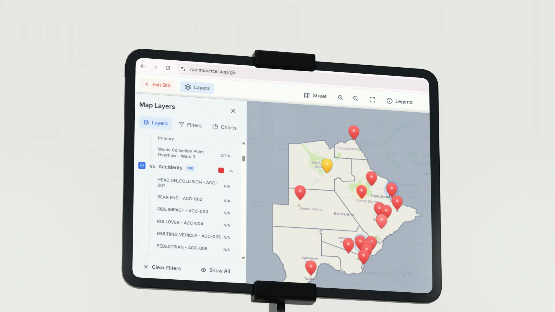
RAPMIS was developed to help the Road Safety Alliance manage roads and wider public infrastructure through a structured digital platform. The system connected infrastructure records, GIS-based location data, user responsibilities, operational workflows, and analytics within one enterprise environment, providing a scalable foundation for infrastructure oversight across Botswana and future regional expansion.
The Mandate
The requirement was to develop a platform that could move beyond isolated road records and support a wider public infrastructure environment. RAPMIS needed to organise asset information across 16 infrastructure domains, present assets spatially through GIS, provide controlled access for 11 user roles, support operational management, and deliver consolidated analytics through one cloud-based system.
The Environment
Public infrastructure management involves assets distributed across large geographic areas, different infrastructure categories, multiple administrative responsibilities, and changing conditions over time. Roads, related structures, facilities, and other public assets must be recorded, located, reviewed, and reported through consistent processes. The Road Safety Alliance required a system that could maintain this complexity without relying on disconnected files, manual registers, or separately managed reporting tools.
Our Role
Centangle worked across the planning, architecture, design, and development of RAPMIS. The engagement included structuring the infrastructure data environment, designing the multi-domain platform architecture, integrating GIS capabilities, implementing role-based access, developing operational dashboards, and preparing the system for cloud deployment and regional scalability.
The Challenge
Managing public infrastructure across multiple categories requires a clear understanding of what assets exist, where they are located, what condition they are in, and who is responsible for maintaining their records. When this information is spread across spreadsheets, files, maps, and departmental systems, it becomes difficult to maintain a reliable view of infrastructure at institutional level.
RAPMIS also needed to accommodate a wider scope than a conventional road asset database. The platform had to support 16 infrastructure domains, control access across 11 distinct user roles, provide spatial visibility through GIS, and organise complex information without making the system difficult for operational teams to use.
The platform needed to manage different types of public infrastructure through one consistent digital framework.
Infrastructure assets required accurate spatial representation so users could understand their location and wider geographic context.
Eleven user roles required different permissions, responsibilities, management views, and access boundaries.
Infrastructure information needed to be transformed into consolidated dashboards, analytics, and decision-ready reports.
The Solution
Centangle developed RAPMIS to manage road assets and public infrastructure through one connected platform. It brought asset records, GIS maps, workflows, analytics, reporting, and role-based access into a structured digital environment.
System Architecture: RAPMIS Public Infrastructure Management Platform
Infrastructure Experience
Gives users access to records, maps, dashboards, workflows, and admin tools.
Manages road and public infrastructure asset records.
Connects asset records with maps, locations, and spatial layers.
Controls user permissions, workflows, and record access.
Stores structured road and infrastructure asset records.
Maintains coordinates, map layers, and location references.
Stores users, roles, permissions, and activity records.
Supports dashboards, reporting, APIs, and data exchange.
FEATURE 01
The platform supports structured asset records across 16 public infrastructure domains within one common management environment.
FEATURE 02
Infrastructure assets can be explored through geographic views that connect operational records with their physical locations.
FEATURE 03
A detailed role-based access model controls what different users can view, enter, update, approve, analyse, or administer.
FEATURE 04
Dashboard and analytical views organise infrastructure information into clearer summaries for operational and management use.
FEATURE 05
The cloud deployment model supports access across distributed teams and reduces dependence on locally managed infrastructure records.
FEATURE 06
REST APIs provide a structured foundation for data exchange, system connections, and future integrations.
RAPMIS followed a system-led delivery process focused on understanding the infrastructure environment, defining the multi-domain architecture, structuring data and access models, designing GIS and dashboard experiences, developing the platform, and preparing it for deployment and expansion.
PHASE ONE
Understanding the road and public infrastructure environment, institutional users, asset categories, management needs, and reporting requirements.
PHASE TWO
Defining how the 16 infrastructure domains, spatial information, user roles, workflows, and analytical requirements would work within one system.
PHASE THREE
Designing dashboards, interactive maps, asset records, reporting areas, and role-specific platform views.
PHASE FOUR
Developing the web platform, GIS capabilities, infrastructure modules, role-based access, analytics, APIs, and cloud environment.
PHASE FIVE
Preparing RAPMIS for operational deployment in Botswana and structuring the platform for wider use and geographic expansion.
RAPMIS brought infrastructure assets, GIS data, user access, and analytics into one connected digital system for clearer management and regional scalability.
A GIS-enabled enterprise platform developed to help infrastructure teams manage road assets, public infrastructure records, maps, workflows, analytics, and role-based access through one connected system.
Work With Us
Centangle helps governments and infrastructure organisations transform distributed asset information into structured, map-based management environments.