

Fragmented Road Data
Road condition information was spread across field reports, spreadsheets, legacy systems, and manual records. This made it difficult to maintain one reliable view of infrastructure health.

Public Sector Infrastructure Partner
Centangle developed RAMS as an AI and GIS-enabled road asset management platform to help infrastructure teams digitise road monitoring, detect visible defects, map road conditions, and plan maintenance with clearer evidence.
Project Overview
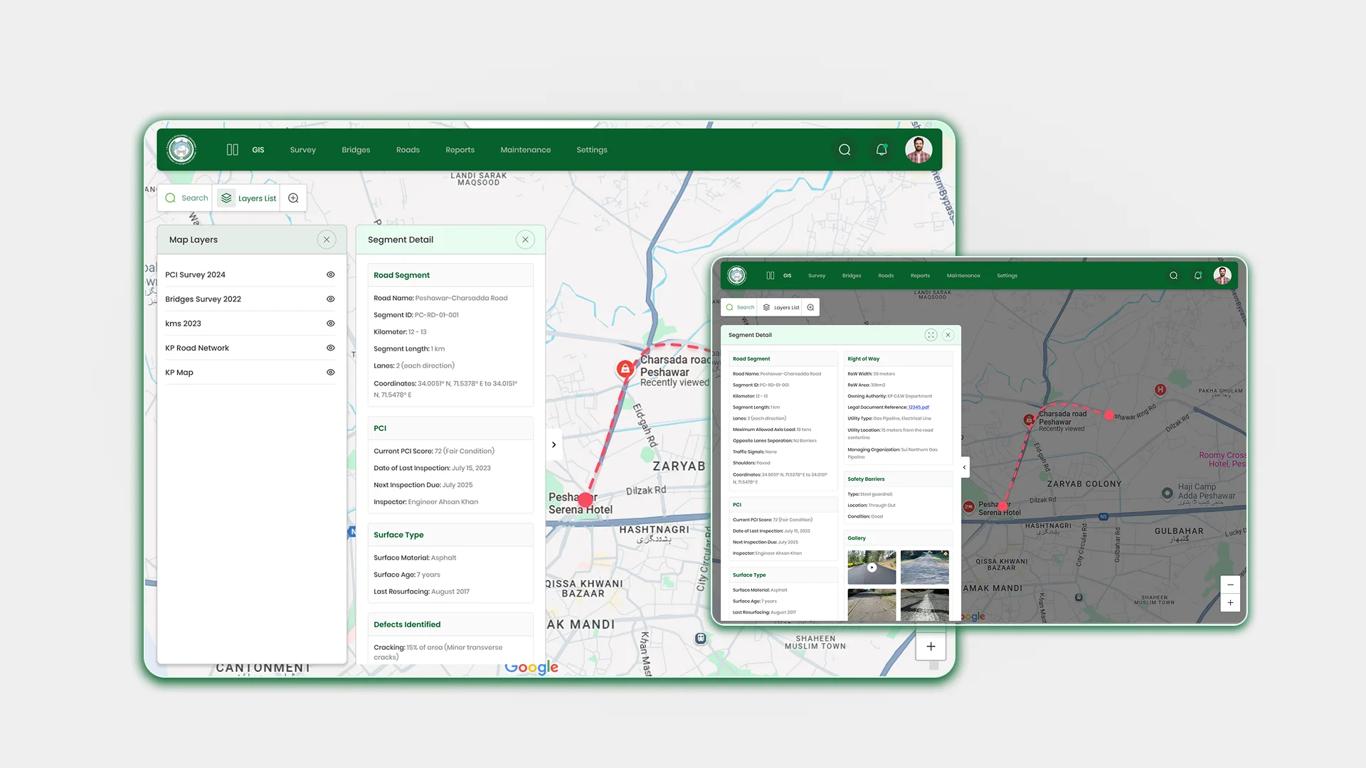
RAMS is an AI and GIS-enabled Road Asset Management System designed to help infrastructure teams monitor road conditions, identify defects, review asset health, and plan maintenance with stronger visibility. The platform brings road data, spatial mapping, AI-supported assessment, dashboards, and reporting workflows into one structured environment.
The Mandate
The requirement was to create a platform that could support large-scale road condition monitoring, automate visible defect detection, centralise road asset data, and help decision-makers prioritise maintenance through GIS-based visibility and structured reporting.
The Environment
Road infrastructure teams often manage condition information across field reports, spreadsheets, legacy records, and manual inspection formats. This creates visibility gaps, makes road conditions harder to compare, and turns maintenance decisions into reactive actions instead of planned interventions.
Our Role
Centangle developed RAMS as a digital road asset intelligence platform combining computer vision, GIS mapping, centralised asset records, dashboards, and workflow-based reporting to make road monitoring more structured, evidence-backed, and useful for infrastructure teams.
The Challenge
Large-scale road monitoring becomes difficult when inspection data is scattered across field reports, spreadsheets, legacy records, and manual formats. This makes it harder for infrastructure teams to compare road conditions, identify defect severity, and maintain one reliable view of asset health.
Without a structured system, maintenance planning often becomes reactive. Teams may struggle to locate priority areas, allocate resources confidently, and make evidence-based decisions across large road networks.
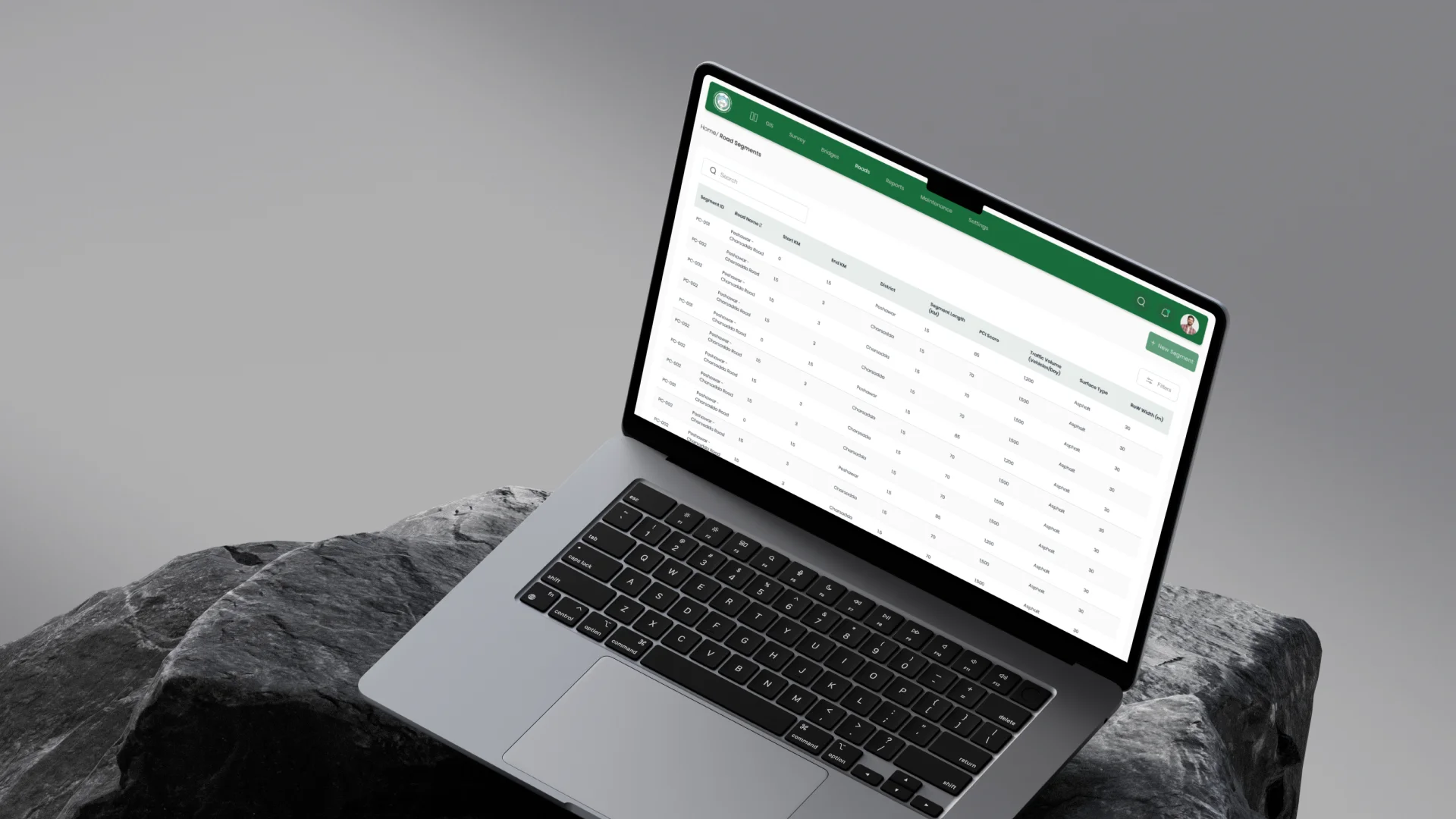
Road condition information was spread across field reports, spreadsheets, legacy systems, and manual records. This made it difficult to maintain one reliable view of infrastructure health.
Field inspections required significant time and effort, while assessment quality could vary across locations, teams, and reporting formats.
Decision makers lacked a central view of road conditions, defect locations, and maintenance priorities across the road network.
Without structured monitoring and prioritisation, maintenance decisions were often made after issues were reported instead of being planned through reliable data.
The Solution
Centangle developed RAMS to bring AI-powered defect detection, GIS mapping, road asset data, and reporting into one connected platform for smarter infrastructure monitoring and maintenance planning.
SYSTEM ARCHITECTURE — AI Road Asset Intelligence Platform
User Interface
Shows road conditions, GIS maps, defects, dashboards, and maintenance priorities.
Manages road records, inspection data, asset conditions, defect status, and maintenance planning workflows.
Identifies cracks, potholes, and surface damage through computer vision to support faster and more consistent condition assessment.
Shows road networks, asset locations, defect clusters, condition views, and reporting dashboards for spatial decision-making.
Stores road records, asset inventory, inspection history, condition data, and location-based infrastructure information.
Centralises field observations, AI-supported assessments, defect details, severity notes, and monitoring updates.
Manages user roles, approval flows, data integrity, reporting standards, and accountability across the monitoring process.
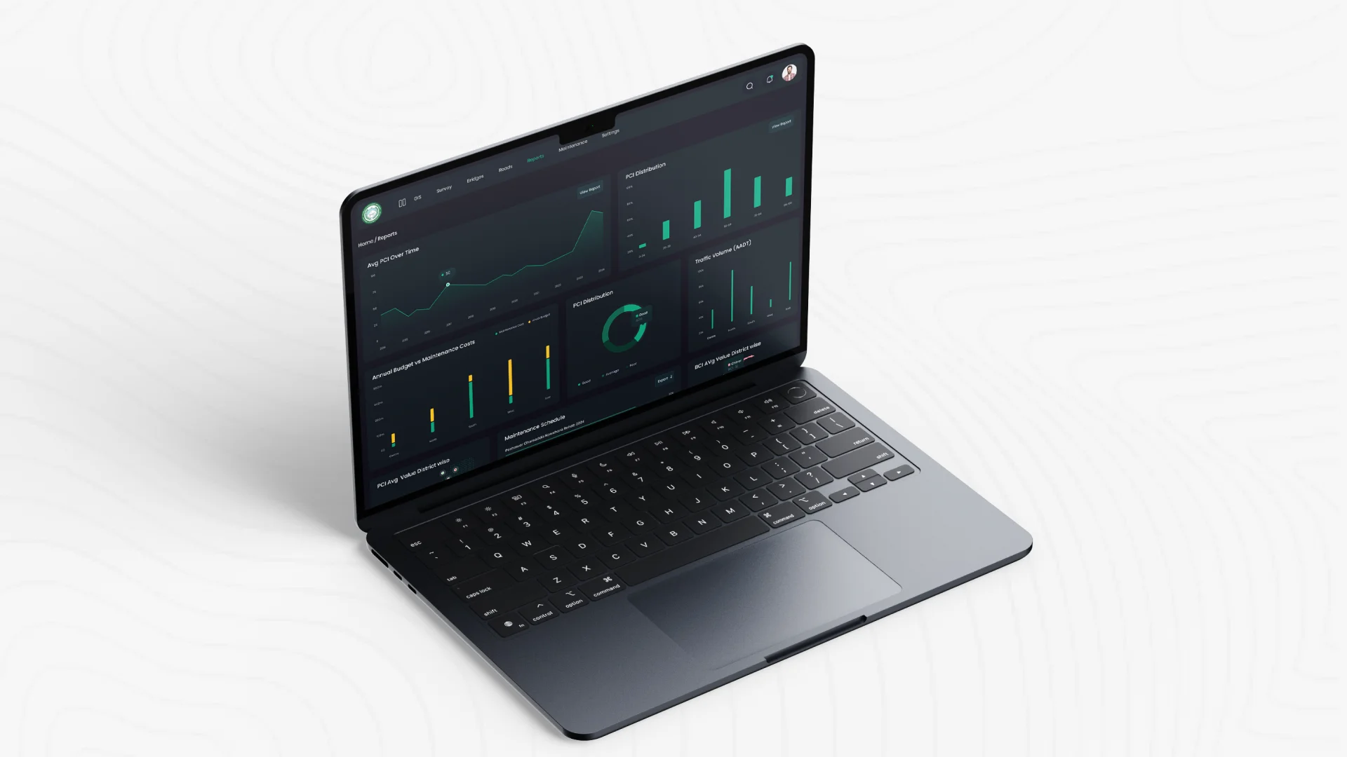
Provides dashboards, maintenance prioritisation, condition summaries, evidence-based reports, and planning visibility.
FEATURE 01
Uses computer vision to detect cracks, potholes, and surface damage so teams can assess road conditions faster and more consistently.
FEATURE 02
Maps road networks, asset locations, defects, and condition data to give teams a clearer spatial view of infrastructure health.
FEATURE 03
Brings road records, inspection data, asset inventory, and condition information into one system for better visibility and control.
FEATURE 04
Supports road condition review, defect visibility, and reporting so decision-makers can plan maintenance with clearer evidence.
FEATURE 05
Provides tailored dashboard views for field teams, planners, and decision-makers based on their roles and responsibilities.
FEATURE 06
Connects inspection, reporting, prioritisation, and maintenance planning so teams can move from defect detection to action more efficiently.
RAMS was delivered through a structured process that connected road data review, GIS architecture, AI supported assessment, platform build, reporting workflows, and deployment readiness.
PHASE ONE
Understanding existing road records, inspection formats, asset data, reporting needs, and monitoring workflows.
PHASE TWO
Structuring how road data, spatial layers, asset records, user roles, and reporting workflows would connect inside the platform.
PHASE THREE
Developing the AI supported assessment layer for identifying road defects and improving inspection consistency.
PHASE FOUR
Building the platform environment with dashboards, GIS views, centralised records, reporting workflows, and maintenance prioritisation support.
PHASE 5
Supporting platform deployment, usage review, reporting refinement, and improvement direction for continued infrastructure monitoring.
RAMS helped shift road asset management from scattered inspections and reactive reporting to a more structured, data backed monitoring system.
Work With Us
RAMS shows how AI, GIS, and structured workflows can help infrastructure teams monitor road assets, detect defects, prioritise maintenance, and make evidence-based decisions with greater confidence.