




3min read
Road maintenance becomes difficult when teams know problems exist but do not have a clear, current, location-based view of where those problems are and how serious they are.
For large road networks, manual inspection alone can quickly become slow, inconsistent, and reactive. Field teams may collect images, notes, and reports, but the information often takes time to organise. By the time it reaches decision-makers, maintenance priorities may already have shifted.
RAMS was designed to change that.
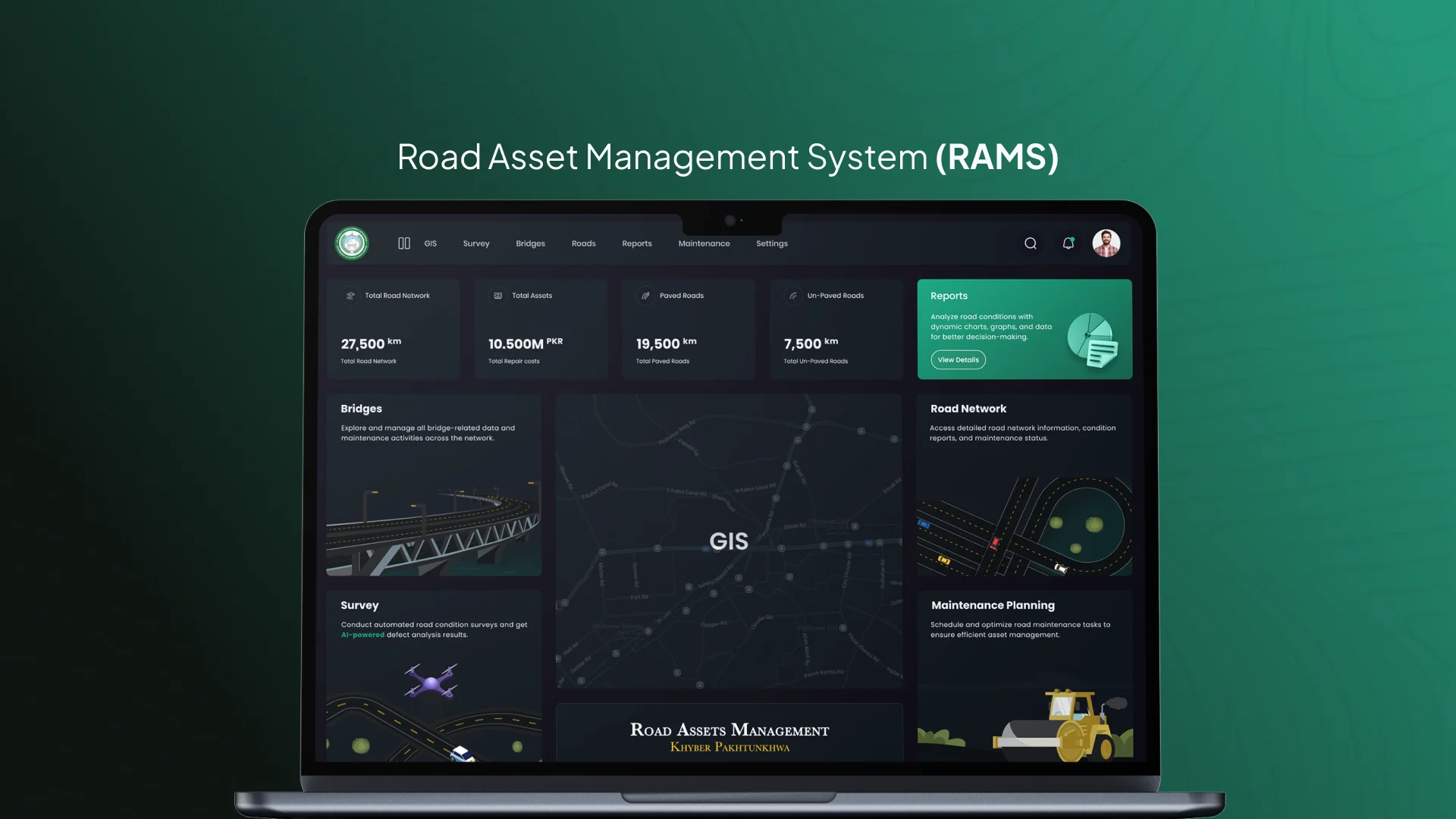
It brings AI, GIS, visual evidence, and reporting into one system so road condition data becomes easier to detect, map, review, and use for maintenance planning.
The Real Problem Is Not Road Damage. It Is Road Visibility.
Every road department knows that damage exists. The harder question is where it exists, how severe it is, and what should be addressed first.
Without structured visibility, teams often rely on field reports, complaints, limited surveys, or manual reviews. This makes planning reactive. Some areas receive attention quickly, while others remain hidden until the damage becomes more serious.
RAMS helps create a clearer operating view. It turns road inspection into structured information that can support planning, prioritisation, and reporting.
Where AI Helps
AI becomes valuable when it reduces the time needed to review visual data.
In RAMS, road imagery can be analysed to identify visible distress such as potholes, cracks, and surface damage. This does not replace engineering judgement. It gives teams a stronger evidence layer before decisions are made.
Instead of manually reviewing large volumes of footage or images, teams can work with detected issues, severity indicators, visual references, and organised condition data.
The value is not just detection. The value is faster review, better consistency, and clearer prioritisation.
Why GIS Makes the System More Useful
Road damage only becomes actionable when it is connected to location.
GIS allows teams to see road issues on a map, understand their distribution, and compare conditions across routes, zones, districts, or maintenance areas.
This helps decision-makers move beyond isolated reports. They can see patterns, identify clusters, and understand where maintenance pressure is building.
For road asset management, the question is rarely only “what is damaged?” The more useful question is “where is the damage, what does it affect, and what should we prioritise?”
From Inspection to Planning
RAMS is not just a road inspection tool. It supports maintenance planning by turning field evidence into decision-ready information.
Once road distress is detected and mapped, teams can review affected sections, compare conditions, and plan repairs with more structure. This helps shift road management from reactive fixes to planned maintenance.
A stronger road asset system gives teams better visibility of condition, location, evidence, and priority. That makes maintenance decisions easier to justify, track, and improve over time.
What RAMS Shows About Infrastructure Intelligence
RAMS shows how AI and GIS can work together when they are connected to a real operational need.
AI helps process visual information. GIS gives that information location and context. Dashboards turn it into views that different teams can use.
Together, these layers help road departments understand their network more clearly and plan maintenance with better evidence.
At Centangle, this reflects the way we approach emerging technology. The goal is not to add AI or GIS for presentation value. The goal is to build systems that help organisations see problems clearly, make better decisions, and manage operations with more structure.
RAMS is an example of how road asset data can become practical maintenance intelligence.
Key Takeaways
- Where AI Helps
- Why GIS Makes the System More Useful
- From Inspection to Planning
- What RAMS Shows About Infrastructure Intelligence
Final Thoughts
Lasting transformation comes from clear goals, honest process design, and technology chosen to support how your teams actually work—not the other way around. If this article resonated, we can help you translate insight into a practical roadmap.